

R2V
Windows v7.5Proprietary commercial software; trial available / 商业专有软件,提供试用
R2V 是 Able Software 的 Windows 地图与工程图栅格转矢量工具。查看官方 7.5 试用版、安装要求、GIS/CAD 输出与数据检查建议。 R2V converts scanned maps and drawings into GIS/CAD vectors; includes official trial and setup guidance.
Windows
AI-assisted content
Information
Learn about the software and its sources
Software overview
- Developer
- Able Software LLC
- Updated
- Oct 21, 2026
- Supported languages
- Not provided
- System requirements
- Official download page: Windows 10/11 (64-bit), 4 GB RAM, 1 GB disk space. Product overview describes a 32-bit application compatible with 64-bit Windows. / 官方下载页:64 位 Windows 10/11、4 GB 内存、1 GB 空间;产品页称应用为兼容 64 位系统的 32 位程序。
- File size
- Not provided
- Download link clicks
- 3
License
Proprietary commercial software; trial available / 商业专有软件,提供试用
Sources and verification
- Resource type
- software
- Pricing
- Full-feature trial during trial period; paid license required afterward / 试用期内功能完整,之后继续使用需购买许可
- Information verified on
- Oct 21, 2026
- Privacy policy
- Not provided
More software informationView the package name, checksum and SHA-256
- Package name
- Not provided
- Checksum
- Not provided
- SHA-256
- Not provided
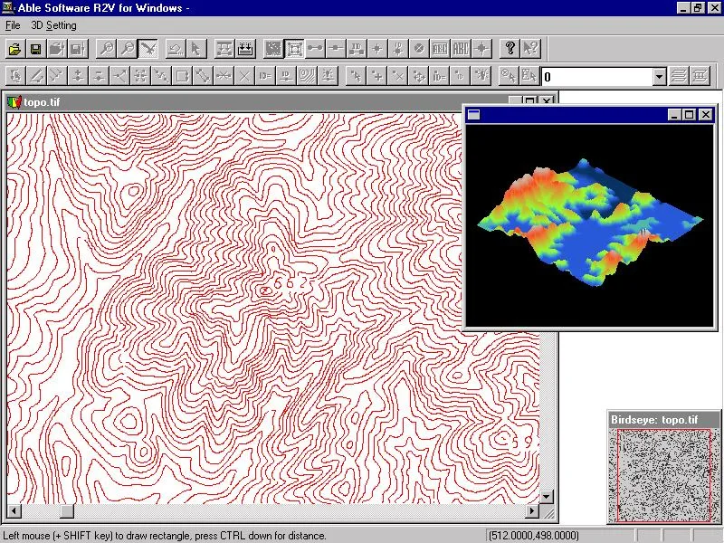
R2V 是 Able Software 的 Windows 地图与工程图栅格转矢量工具。查看官方 7.5 试用版、安装要求、GIS/CAD 输出与数据检查建议。 R2V converts scanned maps and drawings into GIS/CAD vectors; includes official trial and setup guidance.
中文
R2V 是 Able Software 的地图与工程图栅格转矢量软件,可将扫描图处理为线、面和高程数据,导出 Shapefile、DXF 等格式。本文核对官网 7.5 试用版与 Windows 安装条件,介绍 R2V 下载、图像预处理、矢量化检查和常见问题,帮助你在投入批量转换前评估地图质量、坐标精度及授权要求。
R2V 栅格转矢量:扫描地图与工程图的适用场景
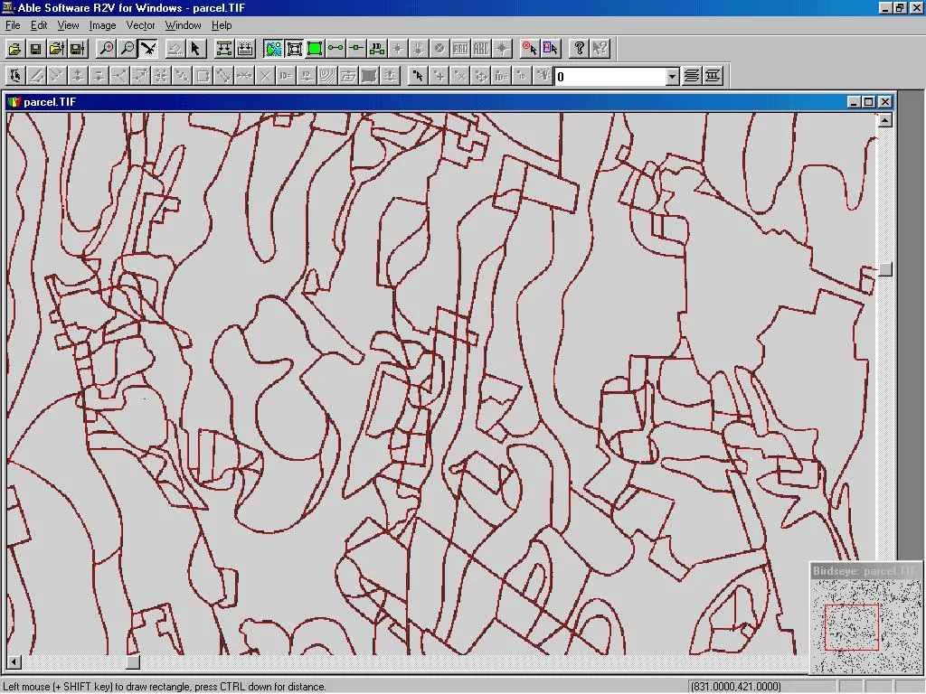
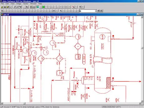
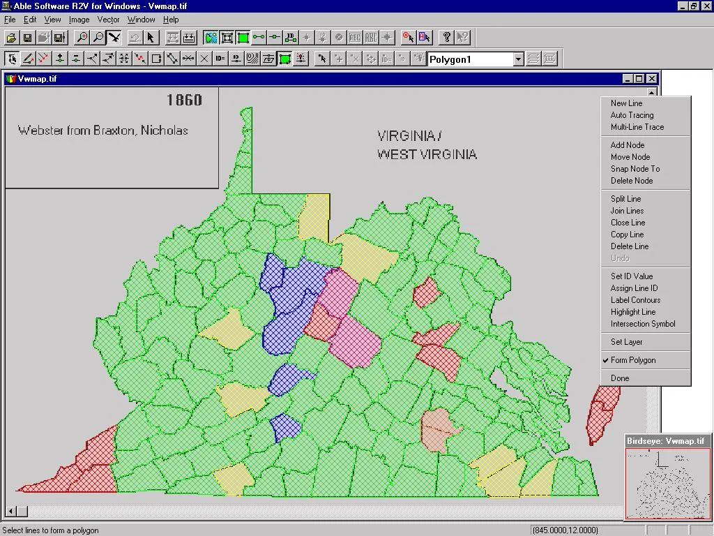
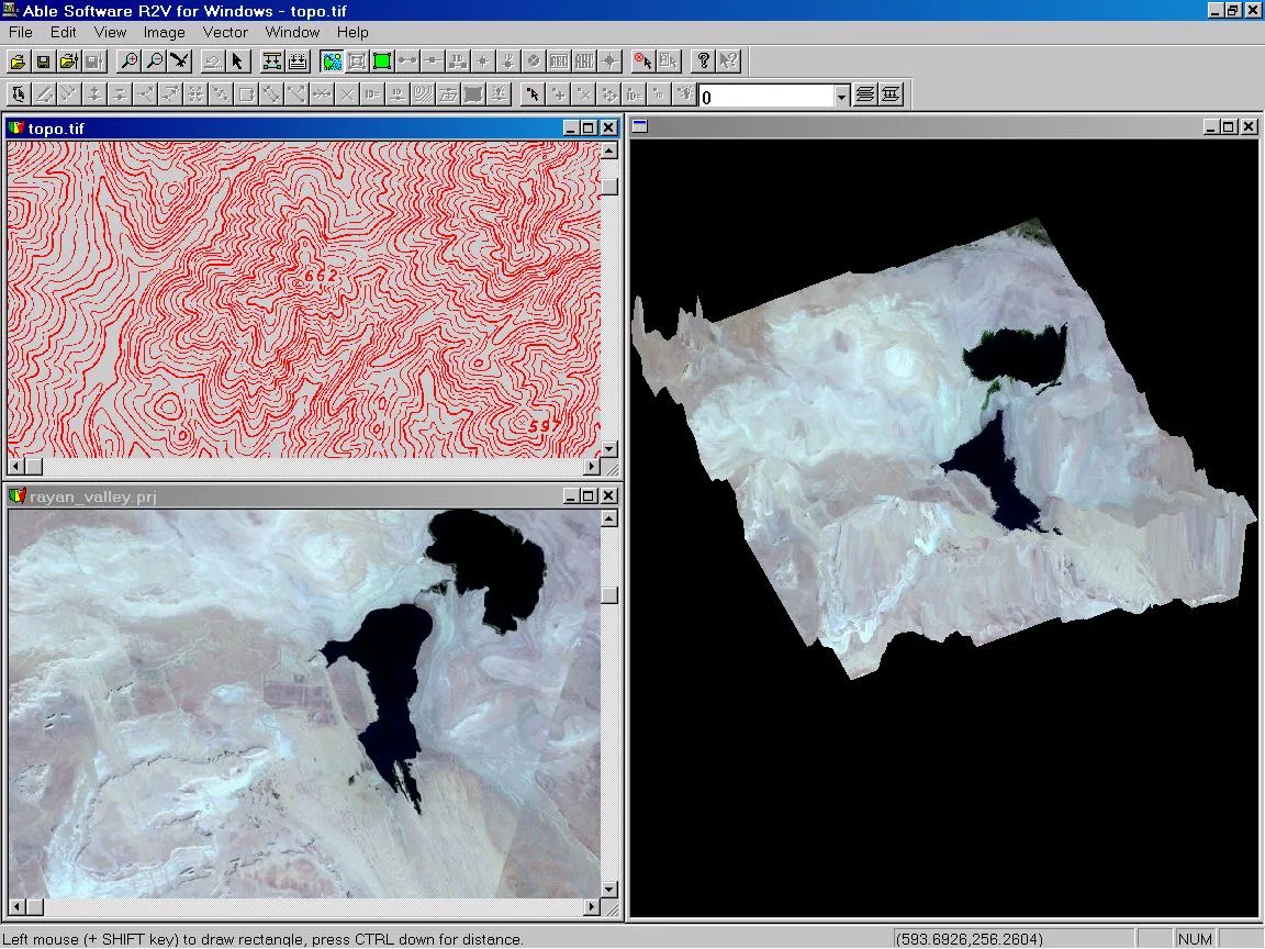
R2V 适合把已有纸质地图或扫描工程图整理为 GIS、CAD 后续可处理的数据。官网列出自动矢量化、交互跟踪与手动数字化三种方式,支持等高线、地块边界、土壤分区及工程线图。对线条清楚、背景干净的图像,可以先尝试自动提取;遇到交叉、断线和文字密集区域,再用交互跟踪与编辑工具修正。
它是独立桌面程序,执行数字化无需先安装另一套 GIS 或 CAD 软件。转换结果的质量仍与原图清晰度、扫描变形、线宽和参数有关;输出能打开并不证明边界与坐标正确。涉及测量、规划等用途时,应由具备相应业务经验的人复核。
从图像到矢量:先分层、再检查闭合与坐标
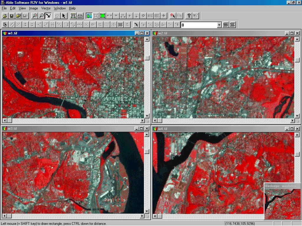
官网支持 TIFF/GeoTIFF、JPEG、GIF、PNG、BMP、RLC 及部分原始卫星影像,覆盖二值、灰度和彩色图像。实际工作可先保存原始扫描件的副本,再选一小块有代表性的区域试转:检查文字是否被误识别为线条、相邻边界是否粘连、细线是否断开。彩色分区图可先利用分类和分色工具区分目标边界,避免把背景纹理一起矢量化。
提取后检查节点、线段衔接、面闭合与属性标签,再处理控制点和地理参考。R2V 提供图层管理、线编辑、标签、GeoTIFF/控制点/世界文件配准以及几何校正。建议先记录坐标系和单位,并用独立控制点检查位置;有地理参考信息与满足项目精度要求是两个需要分别确认的事项。
GIS 与 CAD 导出格式:交付前用样例验证
R2V 官网列出 Shapefile、Arc/Info Generate、MapInfo MIF/MID、DXF、IGES、SVG 等矢量输出,并提供 USGS DEM、ASCII Grid、XYZ、VRML、STL 等地形或三维输出。不同文件承载的几何、属性和坐标信息并不相同,选择格式时应先确认接收软件和项目要求。
官网产品页提供多种样例输出文件。批量处理前,可以先用这些样例确认接收端能否读取,再用自己的小样本检查单位、比例、图层、属性和高程。不要直接将所有任务导为一种格式;例如需要 GIS 属性的工作与只需要 CAD 线条的工作,交付重点会有所不同。
R2V 下载安装与首次转换步骤
官网当前下载卡片列出 Windows 10/11(64 位)、4 GB 内存和 1 GB 磁盘空间。产品说明同时称 R2V 是可在 64 位 Windows 上运行的 32 位应用;这里采用下载页列出的系统条件,不把下载按钮上的“64-bit”解读为应用一定采用原生 64 位架构。
- 打开 Able Software 官方下载页,找到 R2V v7.5,而非同页的 3D-DOCTOR 或其他产品。
- 核对系统与可用空间,通过该产品的公开链接获取 r2vsetup.exe;本文没有下载或运行安装器,也未独立验证文件签名与哈希。
- 运行前查看文件属性、来源及系统提示,再按安装向导选择目录并完成安装。若出现拦截或发布者信息不符,应先向厂商核实文件。
- 首次启动后打开扫描图副本,先做小范围转换,检查线条和坐标,再尝试导出到目标软件。若启动或导入失败,记录报错、系统版本、图像格式和尺寸,向官方支持反馈。
R2V 7.5 当前版本与更新记录说明
截至本次核对,Able Software 下载页把 R2V 标为 v7.5,更新时间显示为 2026 年 1 月,没有列出具体日期。该卡片的 Release Notes 链接回到产品介绍页;已查看页面没有逐项列出 7.5 新增功能或修复内容。因此可以确认官网当前提供的版本标签,但不能据此声称某项现有功能是 7.5 新增。
当前产品页介绍了自动及交互数字化、线面编辑、地理参考、批处理脚本和地形输出等能力,这些应作为产品功能阅读。已有许可证用户升级前,先确认自己的更新权益、项目备份和目标软件兼容性;官网许可说明包括一年更新与邮件支持,实际权益以购买条款为准。
常见问题 FAQ:许可、安全与转换故障
R2V 免费吗?
官网提供试用,试用期限内功能完整,期限结束后继续使用需要购买许可;它不是免费开源软件。单用户、双用户及站点许可的条件不同,购买前请查看厂商当前条款。
从哪里获取安装文件,能保证安全吗?
使用 Able Software 官方下载页的 R2V 链接,避免把榜单中的第三方压缩包当作官方安装器。公开来源不等于独立安全审计;下载后仍应核对文件属性和系统提示,本文不作安全保证。
转换后有碎线、漏线或边界不闭合怎么办?
先查看原图是否有文字重叠、噪点、低对比度和扫描变形,再在小范围调整处理方式,用交互跟踪及编辑补正。不要仅因导出成功就接受全部结果。
多张图拼接后位置不一致怎么办?
检查控制点、坐标系、单位与扫描几何变形,再核对拼接边缘。先用同一项目的小样本验证完整输入、转换与导出流程,再决定是否批量使用 R2V。
English
R2V converts scanned maps to GIS and CAD vectors. Check version 7.5, official trial download, Windows setup, export formats and quality tips before digitizing.
R2V raster-to-vector features for maps and drawings
R2V turns scanned maps and drawings into data that GIS and CAD tools can edit. Able Software documents automatic vectorization, interactive tracing and manual heads-up digitizing. Typical examples include contours, parcel boundaries, soil zones and technical line drawings. Start with automatic extraction on clear source images, then use tracing and vector editing around gaps, intersections and dense labels.
Digitizing runs in a standalone desktop program; another GIS or CAD installation is not a prerequisite. Image quality, scan distortion, line width and settings still affect the result. An exported file opening successfully does not establish positional accuracy. Have the data reviewed for its intended professional use.
Prepare images, inspect topology and check coordinates
The publisher lists TIFF/GeoTIFF, JPEG, GIF, PNG, BMP, RLC and certain raw satellite formats, with binary, grayscale and color input. Keep an untouched source copy and test a representative area first. Look for text mistaken for linework, merged boundaries and broken thin lines. On color-zone maps, classification and separation can help isolate relevant boundaries before extraction.
Review line joins, nodes, polygon closure and labels before relying on the export. R2V includes layers, vector editing, labels, georeferencing with GeoTIFF, control points or world files, and geometric correction. Record the coordinate system and units, and check independent control points. Having georeferencing metadata alone does not establish project-level accuracy.
GIS and CAD export formats: validate a sample first
Able Software lists Shapefile, Arc/Info Generate, MapInfo MIF/MID, DXF, IGES and SVG vector output, plus terrain or 3D formats such as USGS DEM, ASCII Grid, XYZ, VRML and STL. Formats carry different combinations of geometry, attributes and coordinate information. Choose according to the receiving application and the project specification.
The product page provides example output files for compatibility checks. Test those in your receiving software, then convert a small part of your own dataset and inspect units, scale, layers, attributes and elevations. A GIS handoff that depends on feature attributes can have different requirements from a CAD handoff that only needs editable linework.
R2V download, installation and first conversion
The current download card lists 64-bit Windows 10/11, 4 GB RAM and 1 GB disk space. The product page separately describes R2V as a 32-bit application that also runs on 64-bit Windows. Use the download-page requirements when assessing your PC; the download button does not establish native application architecture.
- Open the official Able Software downloads page and select R2V v7.5, rather than another product on that page.
- Check system requirements and free space, then obtain r2vsetup.exe through its public vendor link. The installer was not downloaded or executed for this guide, and its signature and hash were not independently verified.
- Review the file source, properties and Windows prompts before following the installation wizard. If the publisher information is unexpected or Windows blocks the file, verify it with the vendor first.
- Open a copy of your scan, convert a small area and check linework and coordinates before exporting. For a launch or import error, record the message, Windows version, image format and dimensions for vendor support.
R2V 7.5 current version and release-note availability
At this check, Able Software lists R2V v7.5 and “Updated Jan 2026” on its download card, without a specific day. The Release Notes link leads to the product overview. The reviewed pages do not give an itemized 7.5 change list, so this confirms the current vendor version label without establishing which features were added or fixed in that release.
Automatic and interactive digitizing, vector editing, georeferencing, batch scripts and terrain output are documented product capabilities. Existing license holders should confirm update entitlement, back up project files and check receiving-software compatibility before upgrading. The license overview mentions one year of updates and email support; the purchase terms govern actual entitlement.
Frequently asked questions: licensing, source and conversion issues
Is R2V free?
The vendor offers a full-feature trial during its trial period. Continued use afterward requires a license. It is commercial software, with different single-user, two-user and site-license terms; check the current purchase terms.
Where should I obtain the installer, and is it guaranteed safe?
Use the R2V link on Able Software’s official download page. The ranking’s third-party archive is not used as the official installer. A public source is not an independent security audit; review file properties and Windows prompts. This guide gives no safety guarantee.
What if the output has fragments, missing lines or open boundaries?
Inspect the scan for overlaid text, noise, poor contrast and geometric distortion. Test adjustments on a small area, then use interactive tracing and editing where needed. A successful export alone does not validate the whole dataset.
Why do adjoining map sections fail to line up?
Check control points, coordinate system, units and scan distortion, then inspect the join. Validate a complete input-to-export workflow on a small project sample before committing a batch job to R2V.
Platforms and system requirements
- Windows
- Official download page: Windows 10/11 (64-bit), 4 GB RAM, 1 GB disk space. Product overview describes a 32-bit application compatible with 64-bit Windows. / 官方下载页:64 位 Windows 10/11、4 GB 内存、1 GB 空间;产品页称应用为兼容 64 位系统的 32 位程序。
Sources and verification
Information verified: Oct 21, 2026
First published: Oct 21, 2026· Editorial revision: Oct 21, 2026
Similar resources
TeamSpeak
TeamSpeak 是面向游戏、团队、商务和社群的语音通信平台,官方介绍包含消息交流与服务器管理。本条目对应官方列出的 Windows 64 位 TeamSpeak 3 3.6.2。
Windows 10 Media Creation Tool
微软官方 Windows 10 下载页提供媒体创建工具入口和安装介质制作说明,页面将 22H2 标示为最终版本。Windows 10 Home 和 Pro 支持已于 2025 年 10 月 14 日结束;LTSC 版本按各自生命周期执行。

LX Music Desktop(洛雪音乐助手桌面版)
LX Music 洛雪音乐助手桌面版:官方Windows安装包、2.12.6更新、列表备份与播放排查。 / Official desktop packages, release notes, playlist preservation and playback troubleshooting.

EA app
EA app(原 EADesktop)Windows游戏客户端:官方安装、EA账号与游戏库、自动更新和故障帮助。 / EA client setup, game library, account checks, automatic updates and troubleshooting.

WizTree
Windows磁盘空间分析,解释MFT扫描、实际占用、重复候选限制、4.33更新与个人/商业许可。 / Windows disk space analysis with MFT scanning, allocated space, duplicate limits, v4.33 notes and licensing.

Ant Renamer
Ant Renamer 经典版:Windows 批量改名、规则预览、2.13 更新与日期区别、高DPI设置及格式排查。 / Classic Windows batch renamer with rule previews, v2.13 notes, distinct program/package dates and display troubleshooting.
Popular in this category
View all
Snipaste
Snipaste 是适用于 Windows、macOS 和 Linux 的截图、标注与贴图工具。页面整理官方 2.11.3 版本、系统包型、F1/F3 使用步骤和授权区别。 / Snipaste captures, annotates, and pins images on Windows, macOS, and Linux. This guide covers official version 2.11.3, package types, F1/F3 workflow, and licensing.

CorelDRAW Graphics Suite 2026
CorelDRAW Graphics Suite 2026 是适用于 Windows、Mac 与 Web 的商业矢量绘图和版式设计套件,官网提供 15 天试用、订阅及一次性购买选项。本文整理 Windows 系统要求、官方试用入口和 v27.2 补丁前置版本。 / CorelDRAW Graphics Suite 2026 is a commercial vector and page-layout suite for Windows, Mac and Web. This guide covers Corel's 15-day trial, system requirements and v27.2 update prerequisites.
BlueScreenView
BlueScreenView 蓝屏转储阅读指南:官方入口、免安装步骤、停止代码与驱动线索解读、1.55历史更新、空白列表和转储隐私。 / BlueScreenView guide to official setup, minidump records, driver clues, historical 1.55 changes and privacy-aware troubleshooting.
B612咔叽
B612咔叽是Android拍照与照片编辑应用;腾讯应用商店详情介绍智能美颜、贴纸、AI特效、滤镜和拼图功能。
FastStone Capture
屏幕截图、标注与屏幕录制工具,可记录麦克风、系统音频及摄像头等用户选择的输入。
一甜相机
一甜相机由北京快手科技有限公司开发,主打自拍、滤镜与轻美颜、动态贴纸和视频跟拍,也提供照片涂鸦、模板视频和漫画脸效果。
Found incorrect information or a broken link?Help us improve